Can Drones Really Conquer 3D Mapping in the City?
Blog
21 March 2026

Can Drones Really Conquer 3D Mapping in the City?
Drone mapping over an open quarry is a solved problem. Fly a grid, process the images, get a centimetre-accurate model.
A city is not a quarry. Singapore's urban core is dense, vertical, mostly glass, and sits under some of the most tightly managed airspace in the world.
So the honest answer to the question is: partly. Drones have comprehensively conquered building-scale 3D mapping in the city. District-scale mapping is where the constraints bite.
Four problems that don't exist over open ground
1. GNSS is unreliable in urban canyons
Satellite positioning depends on clear sky. Between towers, a drone sees a narrow strip of sky and loses satellites. Worse, signals bounce off glass and metal facades, and the receiver computes a position from a reflected path — multipath error. The drone doesn't know it is in the wrong place; it reports a confident, wrong position.
For flight safety that means degraded position hold. For mapping, it means image geotags that are systematically off, which propagates directly into model accuracy.
How it's solved: RTK or PPK correction against a local base station, visual-inertial odometry that navigates on camera and IMU data when satellites drop out, and ground control points surveyed by total station or GNSS on the ground. Serious urban mapping uses ground control. Anyone quoting survey-grade accuracy in a dense area without it is quoting optimistically.
2. Glass and reflective surfaces break photogrammetry
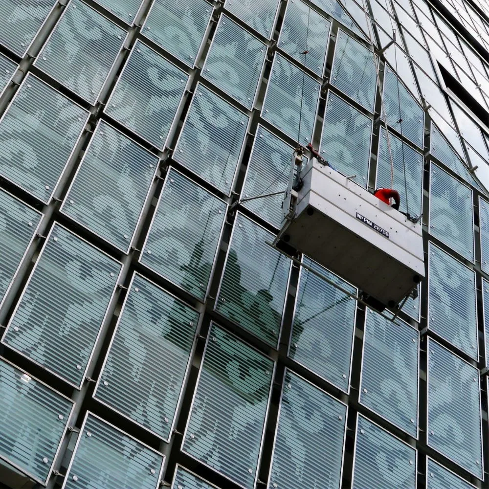
Photogrammetry works by matching identifiable features across overlapping images. A mirrored curtain wall has almost no stable features — what it shows changes with viewing angle, because it is reflecting the sky and the building opposite. The software either fails to reconstruct the surface or reconstructs the reflection as geometry, producing holes, spikes and phantom structures.
How it's solved: LiDAR, which measures range directly and doesn't care about feature matching (though very specular glass at oblique incidence still returns poorly). Overcast-day capture, which kills specular reflection. Many more oblique passes at varied angles. And realistic expectations — a glass tower will always model less cleanly than a concrete one.
3. Airspace is genuinely restrictive
This is the hard constraint, and it is not a technical problem you can engineer around.
Singapore's airspace is shaped by Changi, Seletar, Paya Lebar and Tengah, plus protected areas and controlled zones across the island. Commercial drone operations are regulated by CAAS, requiring operator licensing, aircraft registration and operational permits specifying location, date, time, altitude and purpose. Permit processing takes weeks, and applications can be refused where the location or risk assessment does not support approval.
For a single building, this is a lead-time issue. For contiguous mapping across a district, it is a structural obstacle — you may simply not be permitted to fly across all of it, and the areas you cannot cover are often the ones nearest the most sensitive infrastructure.
How it's handled: address-level feasibility checks before any commitment, permit applications submitted weeks ahead, and — for large-area coverage — accepting that drones will be one input alongside mobile mapping, terrestrial laser scanning and satellite or manned aerial imagery.
4. People, and the risk calculus
Flying over a quarry, the worst outcome is a broken drone. Flying over a CBD walkway, it isn't.
Dense urban operation means overflight of uninvolved people, moving vehicles, and property that will be damaged by anything falling. The regulatory framework reflects that, and so does responsible operating practice: cordoned take-off and landing zones, ground observers, tethered or restricted flight paths where appropriate, conservative failsafe behaviour, and adequate insurance.
Wind is the underrated factor. Tall buildings generate downdrafts, accelerated flow through gaps, and turbulent shedding at corners. Conditions can be calm at ground level and unflyable at level 30 on the same elevation.
What drones do conquer, decisively
Strip out the district-scale ambition and the picture is very different.
Single buildings and their immediate context. This is drone mapping's home ground, and what produces a usable 3D building model. A tower, its podium, its roof plant, and a hundred metres of surrounding context can be captured in a morning to a standard nothing else matches for the money.
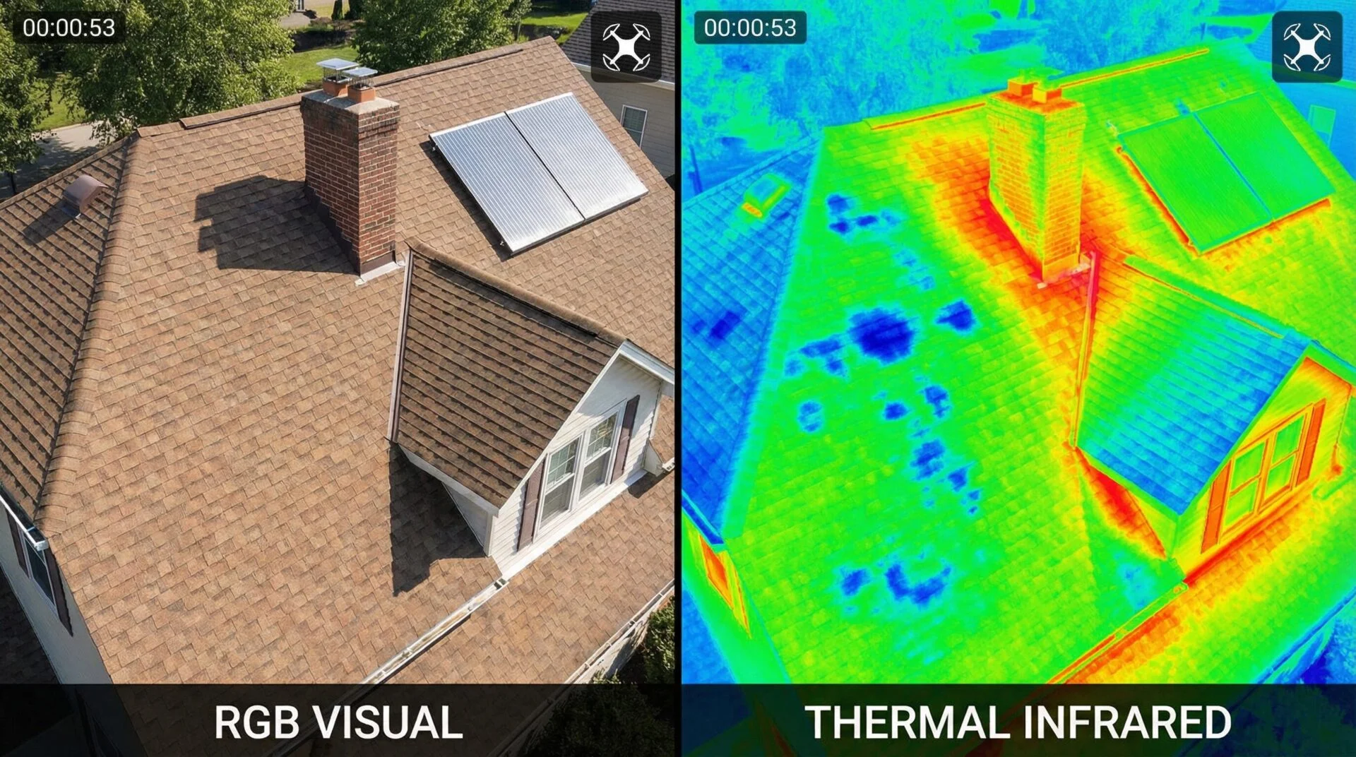
Facades — every square metre of them. No other method documents a building's vertical surfaces as completely or as cheaply — see what that capture actually detects. This is why facade inspection has moved to aerial capture so quickly: the Commissioner of Building Control has approved UAS operated by accredited service providers for the visual inspection of building facades.
Roofs and unreachable elements. Plant decks, parapets, copings, screens, lightning protection. Complete coverage, no access equipment.
Statutory drone building inspection. This is the clearest case of all. BCA's Periodic Facade Inspection regime covers buildings over 20 years old and above 13 metres, on a seven-year cycle, and the Commissioner of Building Control has approved accredited UAS operators for the visual inspection stage — with the Competent Person notifying CBC, attending the flights, and personally reviewing the outputs. Whatever the limits of city-wide mapping, drone building inspection at the individual-building scale is now the mainstream method in Singapore, not an experimental one.
As-built capture for BIM. Envelope geometry accurate enough to model against — see drone photogrammetry to BIM.
Development sites and pre-construction context. Existing conditions, neighbouring structures, sightlines, shadow studies, and the constraints that will govern the design — captured before design decisions are locked in.
Change detection over time. Repeat the same flight plan and you get comparable datasets. Progress monitoring during construction, deterioration tracking during operation.
Confined and awkward geometry. Light wells, atria, internal courtyards, deep setbacks. Places a ground scanner cannot see into and a person cannot easily reach.
The realistic verdict
Drones have not replaced city-scale mapping. Singapore's national digital twin work draws on aerial survey, mobile mapping vehicles, terrestrial scanning, satellite data and existing GIS records, because no single method covers a whole city well.
What drones have done is take ownership of the vertical. Everything from ground level to roof, on any individual building, at a resolution and cost that was simply unavailable a decade ago. In a city where the buildings are the thing that matters, that is not a small territory.
Getting a good result in a dense urban setting
If you are commissioning urban drone mapping, the questions that separate competent providers from optimistic ones:
Have you checked airspace feasibility for this specific address? Before quoting, not after.
What positioning method are you using — RTK, PPK, ground control, or all three? And what accuracy will you actually deliver?
How are you handling the glazed elevations? If the answer isn't specific, the model will have holes in it.
What is your permit lead time, and what happens if the application is refused?
What is your wind limit, and how do you assess conditions at height rather than at ground level?
What formats are delivered, and who owns the data?
Are you accredited for the work? For facade inspection specifically, SAC operates an accreditation area for building facade inspection using drones, recognised by BCA for the periodic facade inspection regime — worth asking about even where the job is mapping rather than statutory inspection, because it signals a documented quality system.
The bottom line
Can drones conquer 3D mapping in the city? Not the whole city — the airspace, the physics of glass, and the risk profile of dense overflight say otherwise.
But building by building, elevation by elevation, roof by roof, they already have. And for almost every owner, developer and facilities manager, the building is the map that matters.