A Drone Can't Spot a Human Hair. But Every Other Anomaly, It Can.
Blog
16 June 2026

A Drone Can't Spot a Human Hair. But Every Other Anomaly, It Can.
A human hair is about 70 micrometres across. No inspection drone flying at a safe standoff from a building will resolve that, and anyone who tells you otherwise is selling something.
Here is the useful question instead: what is the smallest defect that actually matters, and can a drone see it?
The answer is yes, comfortably — and the regulator has already set the number.
The resolution standard BCA works to
For drone-based facade inspection under Singapore's PFI regime, image quality is not a matter of opinion. BCA requires original, unannotated defect photographs in .jpg or .png format at a resolution of 0.15 cm/pixel or lower.
That is 1.5 millimetres per pixel. It means a defect one and a half millimetres wide occupies a full pixel — and in practice, a crack becomes reliably identifiable across several pixels of contrast, so the effective detection threshold sits below that in good lighting.
Which matters, because a hairline crack in concrete is typically 0.1 to 0.3mm. Right at the edge. This is why standoff distance, sensor choice and lighting discipline separate a real inspection flight from a photo tour. A 0.15 cm/pixel ground sample distance is achievable — it just requires flying close enough, with a long enough lens, at a low enough speed, with adequate light.
What a drone reliably detects
Concrete and render
- Cracking, including fine cracking down to the sub-millimetre range under good conditions
- Spalling, from incipient bulging through to exposed and corroded reinforcement
- Honeycombing and surface voids
- Efflorescence and carbonation staining
- Delamination where it has progressed to visible bulging or drummy displacement
Tiles and cladding
- Missing, cracked, chipped or displaced units
- Grout loss and open joints
- Panel misalignment, bowing and edge lipping
- Staining patterns that trace water movement behind the cladding
Glazing and curtain wall
- Cracked, chipped or delaminated glass
- Gasket shrinkage, hardening and displacement
- Sealant splitting, adhesion failure and voids
- Water staining and ponding at transoms
- Condensation between panes in failed IGUs
Metalwork and fixings
- Corrosion at brackets, anchor plates, railings, louvres and copings
- Rust staining running down from concealed fixings — often the first sign of a problem you cannot see directly
- Deformed, missing or loose fasteners
- Failed protective coatings
Roof and elements out of sight
- Ponding water, blocked outlets, membrane damage
- Damaged parapets, copings and flashings
- Condition of plant, screens and lightning protection
- Everything on the fifth elevation that nobody looks at until it leaks
That last category is genuinely underrated. On most buildings, the roof and the upper setbacks are the least inspected surfaces and among the most consequential.
What a drone can't do
Being clear about this is not a weakness in the case for drones. It is what makes the rest of the claims credible.
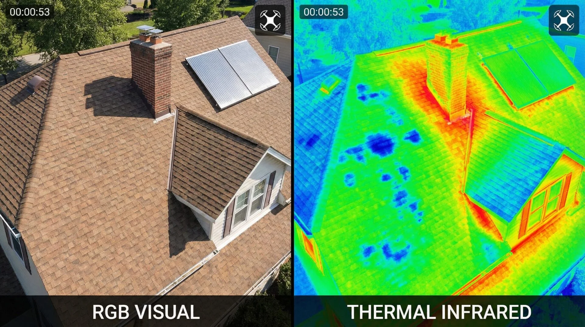
It cannot detect subsurface defects visually. Delaminated render that hasn't bulged, a corroded anchor behind a sound-looking panel, a void in an adhesive bed — none of these have a visual signature until they do. Thermal imaging extends the reach here, but thermography detects thermal anomalies, not defects, and those anomalies need verification.
It cannot tap. Hammer tapping remains the definitive field test for hollowness and debonding. There is no aerial substitute. This is precisely why the Competent Person carries out a full visual inspection and a representative hands-on inspection for each elevation.
It cannot take a sample. Core sampling, carbonation depth testing, chloride content, cover meter surveys, pull-off adhesion tests — all contact work.
It cannot see through obstruction. Dense vegetation, deep recesses, light shelves, closely spaced fins and heavily shaded soffits produce genuine blind spots. A good flight plan minimises them and a good report declares them.
It cannot fly everywhere. Singapore's airspace is heavily constrained. Proximity to airbases and controlled zones can limit or prohibit operations at some addresses, and commercial operations require aviation permits with real lead time. Address checks come before quotations.
It cannot judge. The images are evidence. The engineering assessment is a person's. BCA requires that CPs personally review all inspection outputs including photographs, images, readings and reports, and consult specially trained persons where necessary.
Why coverage beats close-up
Here is the argument that gets lost in resolution debates.
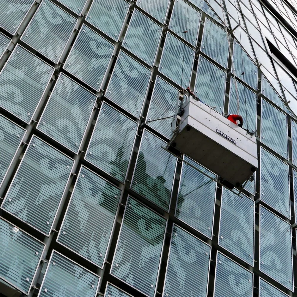
A technician on a gondola gets very close to a small area. Their eyes at 300mm outperform any sensor. But they inspect one drop at a time, they see what is in front of them, and their record is a set of hand-held photographs with approximate locations.
A drone survey covers every square metre of every elevation at a consistent, documented standard. Nothing is skipped because it was awkward to reach. Every image is geotagged and repeatable. Next cycle, the same flight plan produces a directly comparable dataset — and defect progression becomes measurable rather than remembered.
Complete coverage at 1.5mm per pixel finds more real defects than perfect vision applied to 10% of the building — and that coverage advantage is also where the cost savings over manual inspection come from.
The combination that actually works
The strongest inspection programme is not a choice between methods. It is a sequence:
Fly the full facade. Systematic visual capture of every elevation and the roof at compliant resolution.
Analyse and prioritise. Identify anomalies, rank by severity and consequence, and map them to elevation and level.
Add thermal where the facade is clad or rendered. Convert the invisible into a hypothesis.
Target the hands-on inspection at what steps 2 and 3 flagged. Same statutory sampling requirement, dramatically better placement.
Test where the hands-on stage raises questions. Cores, cover meter, adhesion — narrow and evidence-led.
Each step narrows the field. By the time anyone puts on a harness, you know where they should be.
How this maps onto your PFI
For most Singapore building owners this question is not academic — it is the question behind a statutory deadline.
Under BCA's Periodic Facade Inspection regime, buildings more than 20 years old and over 13 metres tall must be inspected every seven years by a Competent Person, who conducts a full visual inspection of every elevation plus a representative hands-on inspection. Drone building inspection is expressly permitted for the visual stage: the Commissioner of Building Control has approved the use of unmanned aircraft systems operated by accredited UAS service providers, with the CP notifying CBC of the UAS details, being present (or having a supervised Facade Inspector present) during flights, and personally reviewing every image and reading produced.
So the detection question resolves cleanly. Everything in the "reliably detects" list above is fair game for drone building inspection and can form part of your PFI visual record, provided the imagery meets BCA's resolution requirement. Everything in the "cannot do" list is precisely what the hands-on stage exists for. The regime is built around that division of labour — it is not a loophole, it is the design.
The bottom line
No, a drone cannot see a human hair. It also cannot tap a wall, take a core, or sign a report.
What it can do is document every square metre of your building's exterior to a resolution the regulator accepts, in a fraction of the time, with nobody suspended in the air — and tell your Competent Person exactly where to spend the access budget.
That is not a compromise on inspection quality. On most buildings, it is an improvement on it.